Kaladungar Fm
Type Locality and Naming
Northern scrap face of Kaladongar hill, Pachan Island, west of Narewari Wandh (Biswas, 1997)
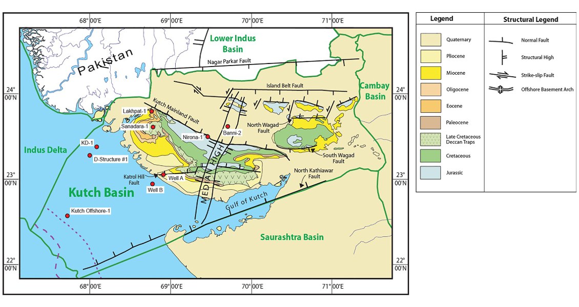
[Fig. Geological and structural map of Kutch, also showing the onshore and offshore wells drilled for oil exploration. (Map by Rasoul Sorkhabi in GeoExpro Dec2014, based on various sources including S.K. Biswas, Current Science, 25May2005)]
Lithology and Thickness
Sandstone. Upper part consists of massive sandstone with calcareous bed whereas lower part is comprised of alterations of sandstone, conglomerate, siltstone and wedges of granite pebbles conglomerate. 472 m in the type section
Relationships and Distribution
Lower contact
Not exposed, but next older regional unit (offshore) is the Nirona Fm conglomerates
Upper contact
Marked by change in facies from sandstone to flaggy limestone of Goradongar Fm. In subsurface, it is disconformably overlain by the Jhurio Fm limestone
Regional extent
GeoJSON
Fossils
Pelecypods, corals, Gastropods, Rhynoconella sp., Progonocythina retuse zone
Age
Depositional setting
Littoral, Transgressive
Additional Information
